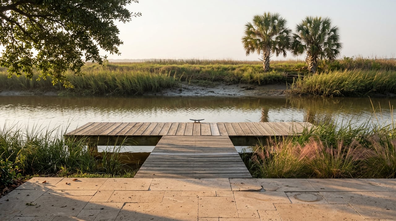
On a Saturday morning at Woodland Park, someone is always carrying a kayak down a short flight of steps to reach the small dock behind the playground. It is not the easy way to get on the water. Half a mile down Highway 98, the public boat ramp at Wayside Park West sits open, paved, and mostly empty, with a straight shot across the bay that cuts the paddle to Deadman's Island roughly in half. Most people go to Woodland Park anyway.
That choice, repeated by enough people on enough Saturdays, tells you something about how Gulf Breeze actually uses its own waterfront. The park system here was not built around convenience. It was built around matching the water to what you're going out to do, and once you see that pattern at Woodland Park, it shows up everywhere else in town.
Two ways to the same island
Deadman's Island sits just off Gulf Breeze's shoreline in Pensacola Bay, reachable only by water. From the public ramp at Wayside Park West, the paddle out is close to half a mile. From Woodland Park's dock, tucked at the corner of Fairpoint Drive and Highpoint Drive, the route runs out through a residential canal and turns to cover close to a full mile, something closer to a fifteen-minute paddle for most people.
On paper, Wayside wins. It's the official launch point, it has a real boat ramp built for trailers, and it's the shorter trip by a wide margin. But the ramp at Wayside also shares its water with every motorboat heading out under the Three Mile Bridge, and the open bay it launches into can pick up chop and wake that a canoe or paddleboard feels immediately. Woodland Park's canal is sheltered, slow-moving, and mostly free of boat traffic, because there isn't much reason for a motorboat to use it.
Why the long way wins
Deadman's Island itself sets the tone for how people get there. Boats are required to switch to paddle or sail power before approaching the island's shoreline; motorized craft aren't permitted right up to the beach. That rule alone filters out a lot of the boat traffic that would otherwise use the shorter Wayside route, and it means paddlers who launch from Wayside still end up finishing their trip the same slow way that Woodland Park paddlers start theirs.
The stairs at Woodland Park's dock do some of that filtering before anyone even gets on the water. You can't back a trailer down them. What's left is a put-in used almost entirely by kayaks and paddleboards, in water calm enough that the crossing feels more like a bayou paddle than an open-bay crossing. For a lot of locals, that trade, a slightly longer paddle in exchange for quieter water and no boat wakes, isn't a compromise. It's the point.
What's actually out there
Deadman's Island has more going on beneath the sand than its size suggests. The area has served over the years as a careening ground where ships were pulled ashore for repair, a shipbuilding site, a quarantine station, and at one point a cemetery. Archaeological surveys of the island have turned up remains connected to all of that history, from shipwreck debris to old barrel wells. None of it is visible walking the beach today, but it's part of why local paddling groups run guided history trips out to the island rather than treating it as just another sandbar.
The island is small enough to circle on foot in a few minutes, with shallow, calm water on the approach that makes it an easy stop for a picnic rather than a destination that requires planning around tides or surf.
The rest of the map sorts itself the same way
Once you notice that Gulf Breeze's parks aren't interchangeable, the rest of the city's waterfront starts to make more sense as a set of specific tools rather than a list of green spaces.
| Park | What locals actually use it for | The detail that matters |
|---|---|---|
| Woodland Park | The quiet put-in for Deadman's Island | Small dock reached by a short flight of stairs, no trailer access |
| Wayside Park West | The official boat ramp, best for motorized traffic | Shares open bay water with boat traffic near the Three Mile Bridge |
| Wayside Park East | Shore fishing and picnics, not paddling | Fishing dock and pier on the opposite side of Highway 98 from the West side |
| Shoreline Park / Shoreline Park South | Walking the Shoreline Loop Trail through oaks and magnolias | A newer wetlands boardwalk extends the loop with an elevated view into the marsh |
| Shoreline Beachside Bark Park | Off-leash dog swimming | A buoy-marked swim zone in the water, with an observation deck for owners who'd rather watch |
| Vista Park North | Fishing and the start of the bike trail | Sits at the foot of the Bob Sikes Bridge, not the Three Mile Bridge |
| Dolphin Island Splash Pad / Sunset Kids Park | Families with young kids | Both sit at the same corner of Shoreline Drive and Sunset Avenue |
None of these swaps are accidental. A family with toddlers isn't driving past the splash pad at Shoreline Drive and Sunset Avenue to find a quieter spot. A paddler isn't choosing Vista Park North over Woodland Park for a Deadman's Island run, because Vista Park North faces a different bridge entirely, the Bob Sikes Bridge toward Pensacola Beach rather than the Three Mile Bridge toward Pensacola. The city's bike trail to Pensacola Beach starts there for the same reason: it's the crossing built for bikes and foot traffic, not boat trailers.
The part that doesn't show up on a map
What's easy to miss, looking at a list of Gulf Breeze parks, is that the city has two bridges anchoring two very different kinds of waterfront activity, and the parks cluster around whichever bridge matches what people are there to do. The Three Mile Bridge side, with Wayside Park East and West, is built for boats and shore fishing. The Bob Sikes Bridge side, with Vista Park North, is built for the bike trail and rod-and-reel fishing off the causeway. Shoreline Park sits apart from both, closer to a nature preserve than a boat launch, which is exactly why it got the wetlands boardwalk instead of a ramp.
Woodland Park doesn't fit neatly into either bridge's orbit, and that's precisely why it works as the quiet option. It's small, it's a little inconvenient, and it's exactly what a slow paddle to a no-motor island calls for.
If you're already carrying a kayak down those stairs some Saturday, you already know this. If you're new to it, the lesson is simple: in Gulf Breeze, the shortest route and the right route aren't always the same one, and the town's whole waterfront is organized around knowing the difference.
If you're weighing a move to this stretch of Gulf Breeze's waterfront, or thinking about what a property near Woodland Park or Shoreline Park is actually worth to you day to day, Coastal Collective Group knows this water the way the locals who use it do. Schedule a Free Consultation and we'll walk you through what living near this particular patch of Gulf Breeze looks like, bridges, docks, stairs, and all.